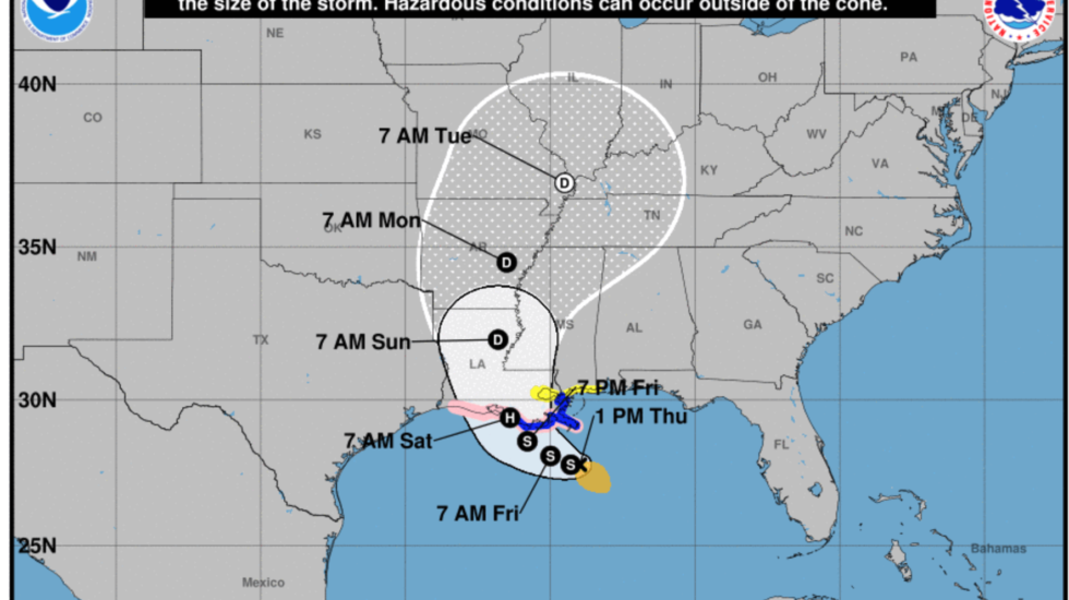
The slow-moving, rain-laden storm system approaching Louisiana strengthened on Thursday and got a name: Tropical Storm Barry.
The National Hurricane Center says its current sustained winds are about 40 mph, as it heads north in the Gulf of Mexico at just 5 mph. When it makes landfall Saturday morning it’s likely to be a hurricane, with winds topping 75 mph.
But the main threat from Barry is potentially disastrous flooding. Torrential rain combined with its slow pace means it will drench everything in its path, from New Orleans to St. Louis and points north.
Louisiana, Mississippi, Alabama and the Florida panhandle were expected to get flood-producing rain on Thursday and Friday, even before the storm’s center arrives.
The Hurricane Center said the surge all along the coast could be “life-threatening.”
Already, the mayor of Grand Isle LA, south of New Orleans, has ordered a full evacuation, saying the coastal town will get 6-10 inches of rain and surge-driven tides rising to more than 3 feet above ground level.
Parts of New Orleans were already flooded after Barry’s outer fringes dumped up to 9 inches of rain on the city Wednesday.
“The rain and storm surge will cause the Mississippi River to swell to dangerous levels,” reports CNN. “The Mississippi River could crest at 20 feet in New Orleans, or 1.3 feet below the record. The city is only protected to a height of 20 feet.”
Louisiana Gov. John Bel Edwards has declared a state of emergency, warning that 10-15 inches of rain could fall over 24 hours from Friday into Saturday. He’s urging residents to have a contingency plan for the safety of family and pets.


