Forecasters are now predicting the possibility of 20-40 inches of rain from Hurricane Florence. The category 4 storm could make landfall somewhere along the Carolina coast by Friday, but because the storm is so slow moving, rainfall totals could be catastrophic.
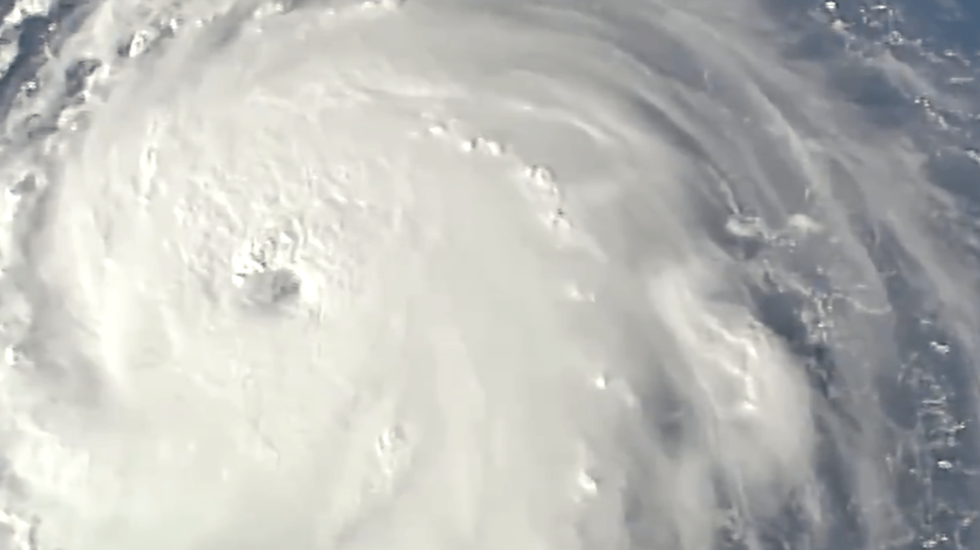
There she is! You can see the relative size of Florence compared to the Carolinas. We'll have an update for everyone with 11am advisory from NHC. pic.twitter.com/dB07RvjKhr
— NWS Wilmington, NC (@NWSWilmingtonNC) September 11, 2018
More than one million people have been ordered to evacuate all along the coast. The mayor of Washington, D.C. has declared a state of emergency for his city.
Here is the latest advisory from the National Hurricane Center:
9/11 11:00 AM EDT: Here are the Key Messages for #Hurricane #Florence. Full advisory: https://t.co/tW4KeGdBFb pic.twitter.com/1GQvCEh4Vs
— National Hurricane Center (@NHC_Atlantic) September 11, 2018
And there are two more storms behind Florence.
Satellite images show 3 Atlantic cyclones (from left to right):
• Cat 4 Hurricane Florence: Forecast to approach Carolinas with 150 mph winds
• Tropical Storm Isaac: Forecast to reach Lesser Antilles near hurricane strength
• Cat 2 Hurricane Helene: No current land threat pic.twitter.com/q9lC8FZM7y
— NBC News (@NBCNews) September 11, 2018


