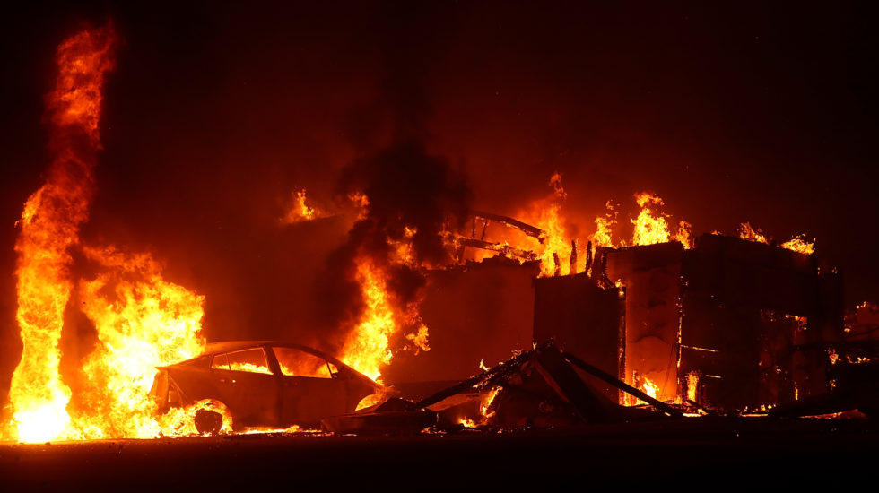
With the horrors of last year’s fire season still fresh in our collective memories, tensions and temperatures are rising in the West as forecasts of high winds and extreme heat begin rolling in.
As we go to press, forecasters have issued the season’s first red-flag warnings of high fire danger for portions of California’s Central Valley and areas north of San Francisco. The weather service is predicting 100-plus-degree temperatures along with high winds and extremely dry conditions.
With those warnings, Pacific Gas and Electric is beginning to cut off power to some communities where fire risk is high. PG&E says the lines will remain de-powered until crews can inspect them, a process that could take days. It was a defective PG&E line last year that sparked the devastating fire in Paradise, California.
Elsewhere, five large wildfires–four in the West, one in Florida–are burning uncontained. Despite these numbers, however, the pace of fires is well below last year. That was a monstrous and deadly year in which wildfires burned almost 9 million acres and killed more than 100 people.
Among the worst:
–Northern California’s Mendocino Complex Fire at 460,000 acres. The largest in the state’s history, it burned for nearly six months.
–The Carr Fire near Redding which killed nine and consumed 1,600 buildings.
–And, of course, the Camp Fire which all but leveled the town of Paradise, destroying almost 19,000 buildings and killing 85 people. It was the deadliest blaze in the U.S. since 1918 when fires in northern Minnesota killed 453.
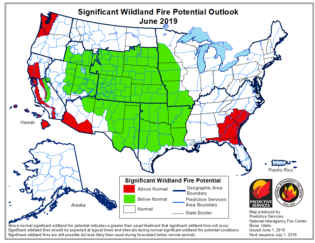
The National Interagency Fire Center in Boise tracks not only the flames but also the conditions that produce them. It says it is guardedly optimistic about the season ahead, at least outside the extreme west coast. A combination of cooler temperatures, more moisture and heavier snowpack in the high mountains may offer a degree of respite. From its latest report:
–Fire activity continued to be well below average during May as a cool, wet pattern redeveloped over the West during the second week of the month and persisted through month’s end.
–High elevation locations in many areas received late season snowfall that further slowed snowpack melting rates.
–Drought continued to recede except across Washington state where it persisted and across the Southeast where a slight intensification was observed.
–Entering June, the driest areas remain areas along the Mexican Border, Washington state, and the Southeast.
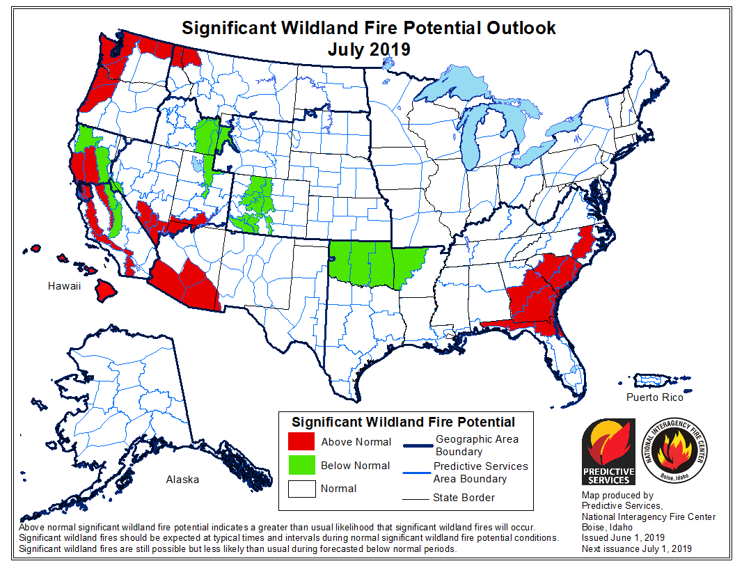
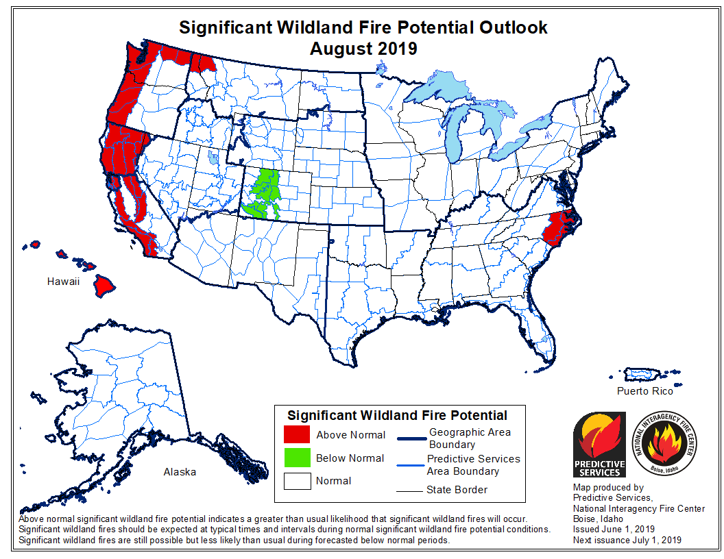
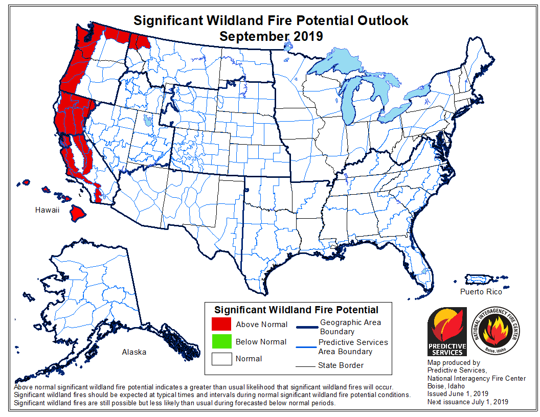
And all of the West Coast is expected to remain hot and dry. The tale is told in the maps below. Red is trouble. As June becomes July and summer flows toward fall, residents from San Diego to the San Juans will be watching the skies and worrying.